
Introduction: The Power of Satellite Imagery in Modern Investigations
Satellite imagery has revolutionized the way we perceive and analyze our planet. Beyond its traditional applications in meteorology and navigation, it has become an indispensable tool in solving complex cases across various domains. From environmental monitoring to criminal investigations, the bird's-eye view provided by satellites offers unparalleled insights. This article delves into real-world instances where satellite imagery played a pivotal role in uncovering hidden truths and delivering justice.
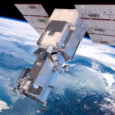
Exposing Environmental Violations: The Case of Illegal Fishing
Illegal, unreported, and unregulated (IUU) fishing poses a significant threat to marine ecosystems and economies worldwide. Traditional surveillance methods often fall short in monitoring vast oceanic expanses. Enter satellite imagery. Organizations like Global Fishing Watch have harnessed satellite data to track fishing vessels' movements, identifying suspicious activities indicative of illegal fishing. For instance, in 2016, satellite data revealed unauthorized fishing activities in the Phoenix Islands Protected Area, leading to enforcement actions against the perpetrators. This technological approach not only aids in real-time monitoring but also serves as a deterrent to potential violators. ...Read More

February 24, 2025, 03:41
Comments:
0

February 19, 2025, 18:24
Comments:
0

April 10, 2025, 17:22
Comments:
0
April 11, 2025, 13:08
Comments:
0

April 28, 2025, 00:23
Comments:
0

February 22, 2025, 17:31
Comments:
0

April 28, 2025, 02:29
Comments:
0

March 10, 2025, 03:18
Comments:
0

April 12, 2025, 03:51
Comments:
0

July 7, 2025, 03:18
Comments:
0
LM
on Vanished Without a Trace: The Unsolved Disappearance of Silvia Menendez in Downtown Los Angeles
Silvia es mi hermana. Si en algún momento tu encuentras este post. Quiero que sepas que te busco, necesito saber que estás bien, segura y a salvo, yo estoy sufrurndo mucho con esta incertidumbre al no saber nada de ti y prnsar que puedas no estar bien.
July 3, 2026, 06:44
LM
on Vanished Without a Trace: The Unsolved Disappearance of Silvia Menendez in Downtown Los Angeles
She is my sister, and I am trying to locate her.
April 30, 2026, 04:53
HC
on Vanished Without a Trace: The Disappearance of Saidy Yolibeth Chirinos in Falfurrias, Texas
Te Xtraño muchooo mi lokitha bella te llevo presente cada día que Dios me presta de vida💔😪
January 31, 2026, 10:14
OT
on Vanished at Sea: The Mysterious Disappearance of Cameron Booth Off Chincoteague's Coast
He was a criminal, an abuser, likely who didn't want to face justice of his actions and took his own life because he could not face the consequences of what he did. The victims have told the family his crimes, with evidence. The family knows he was arrested and convicted of possession of CSAM. They know who and what he was. And they're all so equally sick they live in comfort that the victims don't want to retraumatize themselves over everything he put them through. Dont support this families sick parade of using a monster to get sympathy. He was never ashamed of who he was. He loudly boasted his crimes and justified them. The family shouldn't sit there and pretend, how far from reality are they to sit and post this man publicly on news outlets, websites, knowing who he is. Do they need attention that badly? They don't want the attention from the truth. The victims will never get justice. Do not pray for him o
January 22, 2026, 22:01